
CANHAS
(PARISH OF PONTA DO SOL)
32° 41' 39" N 17° 06' 38" W
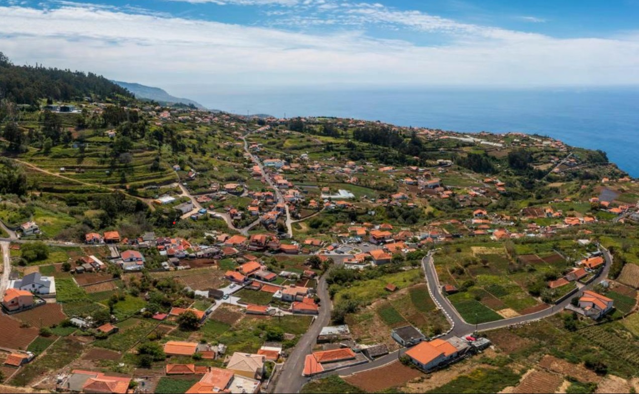
Canhas is a Portuguese parish in the Autonomous Region of Madeira in the municipality of Ponta do Sol, with an area of 13.30 km², 3,769 inhabitants (2011) and a population density of 241.7 inhabitants/km². It is located at latitude 32.6833 (32° 60') North and longitude 17.11667 (17° 7') West, with variable altitude (between 0 m and approximately 1000 m) due to being a mountainous area.
Canhas has an old road that connects Calheta and Funchal, and in 2010 an expressway was built that crosses it and connects it more easily to the municipality's headquarters. It is also crossed by several tunnels, one belonging to an expressway and the other to an old road, which connect the village of Ponta do Sol to Madalena do Mar. It has a coast on the Atlantic Ocean to the south, in an area called Os Anjos. It has mountains to the north, being an important way of accessing Paul da Serra.
Economy
A once essentially agricultural parish, Canhas has gradually been converted into an important economic centre, while retaining its rural feel. Even though agriculture is still a prime industry, civil construction and related industries have conquered a prominent position in the parish.
History
After the Portuguese settled the uninhabited island of Madeira in 1420, the town of Ponta do Sol was founded around 1425. In 1501, the town became the seat of its own district. After a first town was established in what is now the municipality of Canhas shortly afterwards, creating a separate municipality of Canhas by separating it from Ponta do Sol was decided in 1577, but this was not implemented until a few years later. Canhas has been a separate municipality in the district of Ponta do Sol ever since.
Sights
The single-nave parish church Igreja Paroquial de Canhas, also known as Igreja de Nossa Senhora da Piedade (Church of Our Lady of Mercy) after its patron saint, is listed. The baroque church, built in 1756, features neo-mannerist and neo-baroque azulejos and altarpieces made of polished wood. The mannerist chapel Capela de Nossa Senhora dos Anjos (Chapel of Our Lady of the Angels), originally built in 1508, is another listed religious building in the municipality. The Via Sacra was built in 1964.
Another architectural monument in the municipality is the water clock Relógio da Água da Levada do Poiso. The three-story building, built at the end of the 19th century, showed from afar the time intervals at which the allocated irrigation periods could be checked by the farmers connected to the local irrigation canal Levada do Poiso.


👇👇👇😒😒😒
CASCATA DOS ANJOS
(ANJOS WATERFALL)
32.686580, -17.113088
Cascata dos Anjos is a spectacular waterfall going over the old highway ER 101 and is located just outside Ponta do Sol on the island Madeira, Portugal.
When driving west from Ribeira Brava to Madalena do Mar (on road VE3) take the exit (at a roundabout) to Ponta do Sol. Many people park their car before the old tunnel, but you can drive further and this is allowed. The old road goes further for a little over 1 kilometer until you see a forbidden sign in Portugees “exceto moradores” which means except residents. We parked our car here along the road (gps 32.687640, -17.115570) and walked the last two hundred meters.
WARNING
Due to the high number of tourists looking to see the waterfall, traffic jams can form that seem hopeless. Therefore, it is recommended that you leave your car a few hundred meters from the waterfall.


💝💝💝💝💝
SEARCH IN
PONTA DO SOL MUNICIPALITY

Return to mainland Portugal and
to the Azores and Madeira islands

